


Monsoon currently is active in many parts of the country. Recently, the weather department of India said that a low-pressure Area lies over North Bay of Bengal off West Bengal- Bangladesh Coasts with associated cyclonic circulation extending upto upper levels tilting southwestwards with height. It is likely to become more marked during next 24 hours and move westwards to central India during next 2 days.
A cyclonic circulation lies over south Gujarat and neighbourhood at middle and upper troposphere levels tilting southwards with height.
As a consequence of these meteorological features, southwesterly monsoon flow has strengthened over the Arabian sea with southwesterly/westerly winds speed reaching 50-60 kmph along and off Konkan Coast at surface and lower tropospheric levels.
Bihar flood situation worsens, 53.67 lakh people
The flood situation in Bihar worsened on Sunday as water from overflowing rivers inundated fresh areas, while a total of 53.67 lakh people across 14 districts were affected, the Disaster Management Department said.
Heavy Rain Alert over These States
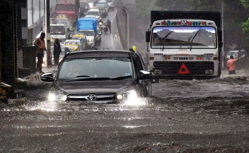
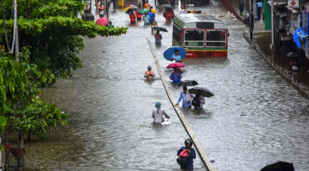
Monsoon currently is in active to vigorous phase over Konkan coast and adj area of west coasts, eastern parts of India covering Odisha and West Bengal.
Under the above favourable scenario, Widespread rainfall with scattered heavy to very heavy falls and isolated extremely heavy falls most likely to continue over Konkan & Goa (including Mumbai) till 6th August and over Madhya Maharashtra (ghat areas) till 5th August 2020 and reduce thereafter.
Widespread rainfall with isolated very heavy to extremely heavy falls also very likely over Gujarat state during 4th to 6th August; over Odisha on 4th August and
over Chhattisgarh and East Madhya Pradesh on 5th August 2020. Isolated very heavy to extremely heavy rainfall also likely over Tamilnadu, Kerala and South Interior & Coastal Karnataka during next 4-5 days.
Maximum & Minimum Temperature
Maximum temperatures were appreciably above normal (3.1°C to 5.0°C) at most places over Assam & Meghalaya and West Bengal & Sikkim; at many places over West Rajasthan, Saurashtra & Kutch and Nagaland, Manipur, Mizoram & Tripura while Minimum temperatures are appreciably above normal (3.1°C to 5.0°C) at many places over West Rajasthan; at isolated places over East Rajasthan and Saurashtra & Kutch; above normal (1.6°C to 3.0°C) at many places over Uttarakhand, Haryana,
Chandigarh & Delhi and West Bengal & Sikkim.